Tibet has always been a place that many people yearn for, and there is even a saying that "go to Tibet at least once in a lifetime". A few months ago, we planned to take a trip to Tibet. So I started to learn some knowledge about traveling to Tibet from experienced relatives and friends, and followed public accounts such as "Xixingbang Tourism" and "Tibet Traffic Police" to refer to itinerary arrangements and grasp real-time road conditions. In mid-July, we learned that the roads on the Sichuan-Tibet line had been successfully repaired and opened to traffic. We prepared spare food, medicine, emergency first aid supplies, clothes, etc., and set off on the 16th.
Day 1
Depart from Shunde around 10 am. There are not too many vehicles on the road and the road is smooth. We drove until we reached Sanjiang County, Guangxi before stopping to stay. It was still early, so I took a stroll in the urban area. The central square of the county town is in the style of the Dong people, but compared with the Dong villages in the countryside, it seems simpler.
The full-day trip is 610 kilometers, the fuel fee is 350 yuan, and the road toll is 355 yuan.
day 2
Depart from Sanjiang County early in the morning and pass through Guizhou Province from south to north. There are many highway tunnels in this section, so it takes longer than usual. At around 3 o'clock in the afternoon, we entered the territory of Sichuan. Continue on and stop at Yibin City for a rest.
The full-day trip is 840 kilometers, the fuel fee is 580 yuan, and the road toll is 550 yuan.
3rd day
Visited the neighborhood today as planned. In the morning, visit the Wuliangye Distillery in Yibin City. As we all know, Chinese baijiu often has a long historical story behind it. Wuliangye is a famous Chinese wine, its origin, cultural history and other information, you can easily learn more about it from the Internet. When we came to Wuliangye Distillery today, our first impression was that it occupies a large area. Even the nearby airport is named "Wuliangye Airport", which shows its great influence! There are many roads in the factory area, and tourists are allowed to drive slowly to watch. The roads are full of traffic, and many trucks carrying raw materials or finished wine are passing through. The air is filled with the smell of food and wine, which is very comfortable. There are many scenic spots here: Wuliangye Liquor Culture Museum, Fenjin Tower, Pengcheng Square, Pinglou, etc. You can also approach the earthen kiln and fermentation workshop. We chose a few roads to drive slowly, took photos at some scenic spots, bought some commemorative wine at the sales office, and then left the winery to go to the next scenic spot.
At noon, we arrived at the Leshan Giant Buddha Cruise Terminal and took a boat to watch the Leshan Giant Buddha. I came here more than a year ago. At that time, the scenic spot was under maintenance. It was a pity that I couldn't see the whole picture of the Buddha. Came again today and finally got my wish.
The cruise ship is moving slowly on the Minjiang River, and the Giant Buddha can be seen from a distance. Tourists stand on the deck of the cruise ship to look out. When the cruise ship arrived directly in front of the Buddha, the captain stopped the boat and let the tourists enjoy it slowly. I saw that the Giant Buddha is as high as the mountain, forming a condescending posture with the river and tourists. With the surging Minjiang River, this momentum is really shocking. In this situation, I really want to sing "A Laugh from the Sea"!
After viewing the Giant Buddha, we packed up our luggage and drove westward to Ya'an, the first stop on the Sichuan-Tibet Line, and checked into the hotel.
The full-day trip is 330 kilometers, and the toll is 130 yuan.
day 4
Starting from Ya'an, we arrived at Luding County after traveling on the highway for more than an hour. Leaving the expressway, turn into the national highway, and run parallel to the Dadu River. Looking out the window, you can see the rapids of the river, and the rapids beat against the mountains or boulders on the bank, and the roaring sound can be heard endlessly. Came to Luding County along the National Highway, and visited the red tourist attraction - Luding Bridge. In 1935, the Red Army came here on the Long March and launched the famous battle of "capturing the Luding Bridge" with the Kuomintang defenders. On the surface of the river about 100 meters wide, the Dadu River rushes down, and the torrents collide with each other, which is very dangerous. There are 9 large iron chains with the thickness of the mouth of a bowl connected between the two sides of the strait. This is the Luding Bridge. There is a distance of 20 to 30 meters between the iron chain and the rushing river. Wooden boards are laid on the iron chain to make it easy for tourists to walk. When the Red Army soldiers won this strategic point, the vanguard commandos crawled forward with naked iron chains and fought fiercely with the enemy. It shows the difficulties and dangers at that time! Therefore, the victory of the Chinese revolution really did not come easily, and we should cherish it!
We walked back and forth to the Luding Bridge, learned some literature introductions, then left Luding County, continued on, and arrived in Kangding City not long after. The westbound expressway ends here, and the car turns into the Sichuan-Tibet section of National Highway 318. The road circled and climbed up Zheduo Mountain, which is about 4200 meters above sea level. This is the boundary between the Han area and the Tibetan area in Sichuan. When I first arrived in the plateau area, I began to feel a little weak and short of breath. But because we had the experience of climbing Jade Dragon Snow Mountain before, we didn't pay too much attention to it, (but it turned out to be wrong afterwards). After looking at the top of the mountain and admiring the scenery for a while, we began to descend the mountain along the highway and head towards Xindu Bridge. The scenery along the way is beautiful, with small rivers, grasslands, herds of cattle and sheep, Tibetan houses, etc., reflecting each other, with the characteristics of Kangding.
Due to the hysteresis of altitude sickness, the previous negligence on Zheduo Mountain gradually appeared when we arrived at Xinduqiao, so we found an inn to stay. In the next few hours, the body felt quite uncomfortable. Fortunately, some members among us do not have strong altitude sickness, she is too busy to take care of us, it is too hard for her. In the evening, everyone realized that they needed to take some medicine, so they took medicine or inhaled oxygen according to their different symptoms. Soon, everyone's condition began to improve, and they seemed to have escaped from altitude sickness, so that everyone could rest peacefully. The owner of the inn is also very good. He saw our situation and comforted us, saying that tourists who are new to the plateau are like this, don’t be afraid, everything will be fine after a while. Then he brought us the oxygen tanks.
The full-day trip is 370 kilometers, the fuel fee is 440 yuan, and the road toll is 130 yuan.
day 5
After waking up early in the morning, everyone’s spirits improved a lot. Maybe they have adapted to the plateau, so they began to appreciate the surrounding environment carefully, walked around the inn, and chatted with the boss for a while. This place is surrounded by mountains, and there is a monastery not far away. On the meadow on the top of the mountain in the distance, there is a string of Buddhist words in Tibetan, as if plants of different colors were planted and then pruned. This is a characteristic of Tibetan areas. In the next few days, we will see this display of characters on many mountain tops. The owner of the inn is also a monk, and he is the director of the nearby monastery. His house was converted into an inn. Every festival, gatherings of nearby villagers or monks in the temple are held here. So the kitchen in his house is very big and there are a lot of tableware.
After breakfast, we left Xinduqiao and continued on our way. Along the way, mountains, rivers, flowers, cattle and sheep are accompanied. The car zigzags along National Highway 318, crosses the 4,700-meter Kazila Mountain, and arrives at Litang County (about 4,000 meters), the "highest city in the world". After a simple lunch, walk on the mountain with a height of more than 4,000 meters, accompanied by meadows and thin snow. Soon, I came to a viewing platform, looking at the blue sky and the mountains in the distance, there appeared a pair of lakes of similar size and shape, like silver plates and jasper, these are the sister lakes. And the snow-capped mountains farther away, Ran Ran is the jade screen behind the pair of sisters. After lingering for a while, we left the viewing platform and went downhill all the way to Batang County, the westernmost county in Sichuan on the southern line of Sichuan-Tibet.
The full-day journey is 350 kilometers, the fuel fee is 380 yuan, and the protective equipment such as oxygen is 200 yuan.
day 6
After consulting the information the night before, we decided to complete the originally planned 3-day journey from Batang to Nyingchi in 2 days, which is also conducive to avoiding overnight stays at high altitudes, so we set off early today. Not long after going out, I encountered a road construction ban, and I had to wait for about 40 minutes before I could move on. After driving for about half an hour, we arrived at the Jinsha River Bridge. This is a bridge connecting Sichuan and Tibet. After passing the Jinsha River Bridge, we have entered the Tibet Autonomous Region! Along the way, the road conditions are steep, often passing through narrow gaps between steep mountains and rivers, or traveling on winding mountain roads. After hovering and climbing to the top of the mountain, you can easily drive on the alpine meadow for a while. Along with the road, the river flows very fast and impacts the boulders or banks in the water, which is very spectacular. But the flow of rivers and rivers is uncertain, when it goes forward and when it goes against it. After checking the map, I realized that the rivers I saw today are: Jinsha River, Lancang River, and Nu River. The three rivers flow in different directions. During this period, we crossed Jueba Mountain, Dongda Mountain, etc., all of which are about four to five kilometers above sea level. At places above 4,000 meters, the air is thin, so you have to walk slowly when you get off the car to see the scenery, and you have to calm down for a while when you get back in the car, so that you can breathe smoothly before moving on. The car engine also seems to be unable to do what it wants. Fortunately, our car is equipped with a 2.0T engine, which can provide surging power when the turbo is stepped in at a higher speed. There is also a comfortable and safe suspension system, which can carry us over mountains and mountains and move forward steadily! Accompanied by the precipitousness and beautiful scenery, we passed Mangkang, Bangda and other areas, drove through the famous seventy-two turns, and arrived at Basu County to rest in the evening.
The full-day journey is 470 kilometers, the fuel fee is 375 yuan, and the protective equipment such as oxygen is 150 yuan.
day 7
As soon as we checked into the hotel last night, we received news that the section of National Highway 318 from Tongmai to Nyingchi had collapsed and was closed again. It was a bit of a collapse at that time! I met many strangers in the restaurant this morning discussing this matter. After comparing the estimated road closure time with the time spent on detouring other roads, we decided to proceed as planned. Among several major mobile phone navigation software, Baidu Navigation actually showed that the road ahead was smooth, which further enhanced our confidence in moving forward (but it turned out that some navigation updates were unreliable), so we rushed all the way with a glimmer of hope. But when we arrived at Midui Glacier, all sources confirmed the exact news that "the road ahead is blocked", so we entered the Midui Glacier Scenic Area for sightseeing. Take a sightseeing bus from the tourist service office to enter the scenic spot center, and walk about 2 kilometers to the viewing platform of the glacier, where you can see the whole picture and structure of the glacier: ice cirque, ice tongue, streams formed by melting ice, and melting ice and snow There are lakes formed by water, and spruce forests on the high mountains that support glaciers. Hiking on the nearly 4,000-meter-high mountain, and having to keep climbing up the stairs, everyone was out of breath and extremely tired. But during the process, everyone did not feel seriously uncomfortable, which shows that we have basically adapted to the plateau.
At the end of the tour, leave the scenic spot and continue westward, and there is another scene beside the road. The road becomes gentle, with tall pine trees lining both sides of the road, and under the high mountains in the distance, highland barley fields, flower fields, grasslands, sheep and farmhouses are accompanied, as if entering a farm in the European continent. Not long after we traveled, we arrived in Bomi County, where we stayed and waited for the opening of traffic.
The full-day trip is 220 kilometers, and the ticket is 260 yuan.
day 8
The road ahead was blocked, and the detour was too far, so we had to wait in Bomi. Wandering on the street in the morning, I met a few tourists from Foshan who were also waiting for the traffic to open, and exchanged contact information with each other so that we could communicate on the road. We searched the nearby attractions and decided to visit the Guxiang Lake Scenic Area.
Guxiang Lake is not far from the county seat, and it will be there soon. The tributaries of the Yarlung Zangbo River come to this area, the river surface becomes wider and the water flow is slow, so it forms a scenic spot similar to a wetland park with the pine forests on the adjacent mountains and flat land. There are two leisure tourism spots developed here, which also seem to be tourism poverty alleviation projects that have emerged in recent years, but I don’t know if the impact of the new crown epidemic is still a management problem. Such a quiet and beautiful leisure resort has few tourists! In addition, our road ahead was blocked and we lost our budget in terms of time, so our mood was not so smooth, and we didn't appreciate the scenery very carefully.
In the afternoon, we returned to the hotel, borrowed tableware from the store, and went to the market to buy fresh matsutake and meat. Once the food comes out, the mood is naturally relaxed!
Full day trip: 50 km.
Day 9
In the morning, I wandered the streets again, bought some specialty products, and stayed at the hotel to wait for traffic news. At around 2:00 p.m., when they learned that the Armed Police Force had built an access road next to the landslide site, the road was unsealed and unilateral release was allowed. Everyone cheered and immediately packed their bags and set off. Because there are too many stranded vehicles, traffic jams are inevitable on the road. After passing two places that had landslides recently, seeing the thrilling scene of road damage is really scary! Before and after the rush repair section, many armed police, traffic police, civilian police, etc. directed and diverted passing vehicles to quickly pass through dangerous places. On one side of the landslide is a cliff and on the other side is a torrent of river, looking down to a depth of 20 to 30 meters, it is very thrilling. Emergency repair engineers and large machinery are working nervously at the risk of danger. When we passed the top of the small hill on the temporary sidewalk, a large rock blocked our car. Several armed policemen signaled us to stop, and then they worked together to move the stone away with their bare hands and let us pass. I couldn't help opening the car window, thanking them repeatedly, and respecting them!
After passing the control point, the road was clear and soon reached Lulang Town. Here I saw the European-style Lulang Meadow, and then went on through the fairyland-like Lulang Forest. We walked slowly to watch, and then circled down the road until we had a rest in Nyingchi City.
The full-day trip is 220 highways, and the fuel fee is 185 yuan.
day 10
Early in the morning, the sky was dark and drizzling. We estimated that the visibility of the Yarlung Zangbo Grand Canyon was not good, so we had to give up the tour plan of this scenic spot. So we started from Nyingchi and went straight to Lhasa via the Lin-La Expressway. Half an hour after departure, the sky cleared and the surroundings suddenly became colorful. Under the blue sky and white clouds, sometimes you can see the hillside covered with green trees, and in a blink of an eye, the green trees are replaced by brown boulders, or under the laterite mountain, a large golden rapeseed field suddenly turns into a continuous meadow... It can be said that the beautiful scenery is endless and dizzying!
In the afternoon, we left the expressway, passed the inspection and quarantine station, and entered the urban area of Lhasa. It was still early, we studied the map and found that it was not far from Yamdrok Yongcuo, so we set off directly to the scenic spot. There is a tourist service center more than 30 kilometers away from the scenic spot. Buy tickets here, then drive along National Highway 349, cross the 5,000-meter-high Gangbala Pass, and you will be able to see Yamdrok Yongcuo in the distance. It is one of the holy lakes on the three plateaus of Tibet. From a distance, it looks like a sapphire inlaid on a 4,400-meter-high ridge. Continue to move forward to reach the lake, and you can see the blue water of the lake, forming a harmonious and mysterious picture scroll with the snow mountains in the distance, the meadows nearby, and the rapeseed flowers by the lake. We walked near the viewing platform by the lake, but walking up and down at an altitude of nearly 5 kilometers was not an easy task. After a while, we were out of breath and pale! I had no choice but to slow down and take a few steps to rest, but my eyes were greedily staring at the picture scroll. Then go back the same way and go straight into Lhasa city to rest.
After dinner, we walked several kilometers in the city to the Potala Palace Square to enjoy the night view of the Potala Palace. Under the illumination of the lights, the Potala Palace is like a sanctuary lost in the sky, floating in the air, resplendent with gold and colorful clouds. Many tourists in the square come to this check-in point to stop and admire and take pictures. Here you can chat with a few tourists casually, share your travel experience and itinerary planning with each other.
The full-day trip is 600 kilometers, and the fuel fee is 365 yuan.
Day 11
Since we booked tickets to visit the Potala Palace one day in advance, we could visit it early in the morning. I believe everyone is very familiar with the construction and reconstruction history of the Potala Palace. When you see it up close and live in it, you will still be amazed at its majesty and strangeness. This is a large palace built on a mountain, more than 400 meters wide, more than 300 meters deep, and nine floors high. The appearance is complex and changeable, magnificent. The appearance shows three colors of red, white and yellow, the colors are bright and coordinated, and it looks very comfortable. From the aisle connecting the main hall, you will go up the stairs, and you will see different styles every time you turn a corner. In the walkway guardrail building, hay is sandwiched between the bricks and stones. It is believed that the walls of the main building have similar structures. After checking the information, it turned out that this is Baima grass, which has been soaked in liquid medicine, which can lighten the wall and help the ventilation of the room. Looking far away from the aisle, you can see the whole picture of Lhasa, which is very fresh and refreshing. On the alpine meadow in the distance, the four characters "Long Live the Motherland" are inlaid.
Walking up to the gate of the palace and entering the hall, you can see numerous halls and rooms overlapping each other; thangkas and murals can be seen everywhere; golden statues of Buddha, Arhat and Bodhisattva are all there. The golden fetishes on the top of each hall reflect dazzling golden light under the sunlight. In the hall on the highest floor, there is a golden pagoda donated to the Potala Palace by Emperor Qianlong. According to the guide, the pagoda weighs more than three tons. After admiring it for a while, we followed the flow of tourists down layer by layer, left from the back mountain, and walked slowly around the palace. I saw many monks devoutly making pilgrimages around the Potala Palace. Every few steps they walked, they kowtowed to the ground, reciting Buddhist scriptures, and many tourists gave change.
After leaving the Potala Palace, we came to the square again and continued to appreciate this masterpiece from a distance. Then, while shopping in the city, I came across a small restaurant that said "Cantonese Cuisine", so I went in immediately, heard the friendly Cantonese, and tasted the strong hometown flavor!
In the afternoon, we visited the Jokhang Temple. This is a large Tibetan monastery built by Songtsen Gampo, a powerful figure in Tibet during the Tang Dynasty. The local people believe that the Jokhang Temple is located in the heart of Tibetan Buddhist temples in China and the Buddhist center of the world, so in their hearts, the Jokhang Temple is very sacred. The temple is very majestic, its main hall sits east to west, and Sakyamuni Buddha is enshrined in the center. Surrounding the main hall are small halls for Buddhas and Bodhisattvas. Butter lamps are lit everywhere in the temple, exuding a peculiar fragrance, which is different from the choking incense smoke in temples on the southeast coast. We paid homage to the Buddha in the main hall, and went to a few small halls to pay homage to the Buddhas. Then we climbed to the second-floor rooftop to enjoy the main building of the temple, and then left the Jokhang Temple. During today's tour, our group invited a tour guide to explain, let us know some knowledge about Tibetan Buddhism, Jokhang Temple, Potala Palace and other precious buildings, as well as folklore, etc., it is very worthwhile.
Going out from the Jokhang Temple is Barkhor Street. The shops on the street mainly sell Tibetan handicrafts and special products. We wandered around for a while, then went back to the hotel to rest.
Full-day city activities, tickets, etc. 1,000 yuan.
day 12
Get up in the morning, pack your luggage, walk on the nearby pedestrian bridge to look at the Potala Palace in the morning light, and then reluctantly leave Lhasa. After driving northward on National Highway 109 for about 4 hours, we arrived at Damxung County and turned into Namtso Scenic Area. I bought tickets at the visitor center, and after a simple lunch, headed towards the center of the scenic spot. During the journey, we came to a viewing platform. We were admiring the scenery. A little girl jumped out of the shed next to herdsmen. There was a cheerful smile on the plateau red face, and her eyes blinked. Like talking, very cute. We pressed the shutter while stuffing her with snacks. This small episode added a touch of cheerful atmosphere and memory to our itinerary!
Continue to move forward and turn over the Nagenla Pass at about 5,200 meters, and you can see Namtso. It is also one of the three holy lakes on the plateau in Tibet, with a large area, which is said to be about the same size as Shenzhen. Walk about one kilometer from the parking lot to the lake. The lake water is very clear.
It is extremely transparent under the sunlight, and it is very beautiful against the snow-capped mountains and blue sky and white clouds in the distance. Some Tibetans dragged white yaks to the lake and let tourists ride them to take pictures. They sang Tibetan songs loudly, which added a lot of vitality to the beautiful scenery.
After visiting Namtso, it is still early, so we continue our journey. Since the conditions for us to go to Mount Everest and the Ngari area are not yet mature, after visiting Namtso, it means that the main tourist spots of this trip to Tibet have been completed. When we leave Namtso, we will inevitably feel a little bit reluctant.
We planned to take the northern Sichuan-Tibet line back to Sichuan, so we left Damxung County and continued northward along National Highway 109. This section of the road was basically more than 4 kilometers. Sometimes I ran into a running train on the Qinghai-Tibet Railway, as if entering an old movie scene, and everyone was in an uproar. After more than 3 hours of travel, we arrived at Nagqu City at an altitude of 4650 meters and checked into the hotel. It is the first time to stay in such a high place, and the oxygen supply in the room is not very good. So some headaches and shortness of breath at night.
The full-day trip is 350 kilometers, and the fuel fee is 470 yuan.
day 13
I didn't rest well last night due to altitude sickness, and I finally looked forward to the dawn. Nagqu is the intersection of National Highway 109 on the Qinghai-Tibet Line and National Highway 317 on the Northern Sichuan-Tibet Line. We chose National Highway 317 to go east, and there are plateau areas of 4 to 5 kilometers along the way. The scenery is dominated by alpine meadows and some Tibetan buildings. At the junction of Nagqu and Suo County, the road surface is mostly under maintenance, with potholes, and driving is time-consuming and energy-consuming. After passing through Baqing County and Dingqing County all the way, it was almost dark when we arrived in Leiwuqi County, so we rested here.
The full-day trip is 530 kilometers, and the fuel fee is 440 yuan.
day 14
Starting from Leiwuqi, continue eastward. After turning over many mountains of 4-5 kilometers, and turning countless sharp turns, we crossed the Jinsha River Bridge at around 4:00 p.m. and returned to Sichuan. After more than 3 hours of driving, we entered Ganzi City in the evening.
600 km full day trip.
day 15
Leaving Ganzi City, head towards Seda, and arrive at Seda Buddhist College at noon. Knowing at the gate of the college that this place is not open and that cars and pedestrians are not allowed to enter, everyone is inevitably a little bit depressed. After walking around for a while, I met a local who said that he could take us on foot to the nearby Shanyuanguan Buddhist Academy, so we set off with that "guide". The road is not very far, but climbing a small hill at an altitude of more than 4,000 meters is also a very strenuous task. Fortunately, I have been active in the plateau for a few days, and I have gotten used to it, so except for a few members who have to be supported by "guides", others can barely cope. After walking for about 40 minutes, you can see the interior of the Buddhist Academy from a distance. A little ahead, we saw other tourists walking, so we followed the school road.
All you see along the road are small red wooden houses, which are where teachers and students live. There are men, women and children who go in and out of the cabin, and they are all wearing monk clothes. Walk along the school road to a bus stop, which is the center of the campus, and there is a stepped walkway next to it to climb to the top of the mountain. We walked up for a while, and we could see the whole picture of the Buddhist Academy. However, seeing the green grassy green hills standing under the blue sky, from the foot of the mountain to the halfway up the mountain, there are countless red wooden houses, large or small, densely built, which is very spectacular, and the visual impact is really amazing. Overlooking the bus station square, pedestrians shuttle back and forth, all of them are teachers and students wearing saffron monk robes. This kind of scene is both fresh and mysterious, and there seems to be a great sense of distance between it and the picture, but it is obvious that you are in it, and this feeling is very strange. Since the college has not yet been fully opened, we did not find anyone to consult or conduct more research, and we did not go up the mountain to the celestial burial platform. After staying for a while, we left Seda Buddhist College and continued our return journey to Malkang County for accommodation.
The full-day trip is 350 kilometers, the fuel fee is 340 yuan, and other expenses are 200 yuan.
Day 16/17
From Maerkang to Shunde, Guangdong, after passing through Sichuan, Guizhou, Guangxi and other provinces, there were not too many stays in the process. According to the rhythm of the road, I returned home on the evening of August 1, and ended the hardships, thrills, and very happy journey of.
The two-day trip is 2,050 kilometers, the fuel fee is 1,000 yuan, and the road toll is 1,100 yuan.
postscript
The above is the diary of this Sichuan-Tibet trip. Combining the entire itinerary, traveling on the Sichuan-Tibet line, it can be said that the scenery is on the road, and every step and every angle is a beautiful picture. The planned scenic spot allows tourists to get closer to the center of the scenic spot, so they should also go in and enjoy it. Driving and life experience are also the value embodiment of the itinerary. The road conditions of National Highway 317/318 are relatively steep, with many bends and narrow roads. Often there is a sharp bend within tens of meters or more than a hundred meters, or between cliffs, riversides and tall mountains. For example, if you want to overtake the vehicle in front, you often have to wait for several opportunities, especially for large trucks. Fortunately, many large truck drivers are of high quality. They drive ahead, and when they find an opportunity between curves, they will reach out the window to signal the vehicle behind to speed up and overtake on the curve.
However, on this difficult and oxygen-deficient plateau road, we often meet motorcycle warriors, cyclists, hikers with luggage, and even a few pilgrims who kowtow to the ground along the way. I am really touched by their perseverance! They form a strong contrast with the natural environment and road conditions of the Western Regions, becoming a special landscape and embellishment of nature.
Under normal circumstances, it takes about five days to reach Lhasa from near Chengdu. If there is a sudden road interruption or road maintenance, you can only wait in place. Therefore, the daily rest location should be well designed, because on this section of the road, only the county towns have relatively better food and accommodation conditions, and consideration should also be given to lodging in counties with lower altitudes to ensure the quality of rest. Between the two counties, it often takes 2 to 3 hours by car to arrive.
Although we have been to other plateau places before, we still experienced altitude sickness to varying degrees during this trip. Explain that altitude sickness will vary depending on the individual's physical condition, mental preparation, weather conditions and other factors. Through this experience, I have the following experience: People who come to the plateau for the first time should not be afraid psychologically, nor should they underestimate them. Before entering the 3500-meter area, it is best not to eat too much, so as not to increase the load on the digestive system. When reaching more than 3500 meters, avoid too much movement (such as jumping, running, etc.), and do not blow cold wind. If you feel a little uncomfortable in your body, you should inhale oxygen in small amounts and at intervals to slow down the rate of organ hypoxia. When symptoms such as headache and vomiting occur, corresponding drugs should be taken in time to relieve the pain. When the physical condition is more stable, the oxygen inhalation interval should be extended until it stops.
After entering the plateau, in a calm state, it is generally more intense for 1 to 2 hours, but as long as the control is adjusted properly, it will start to ease in 6 to 8 hours. It is best not to inhale oxygen all the time, otherwise it will take a long time to adapt.
The trip to Sichuan and Tibet is a journey of experiencing scenery and life, a journey of driving challenge and fun. Although it has been over for a period of time, the joy and hardships involved still give us endless aftertaste! Looking forward to a more exciting trip next time!
The above text and pictures are original, please do not steal, otherwise it may involve legal liability! ! !
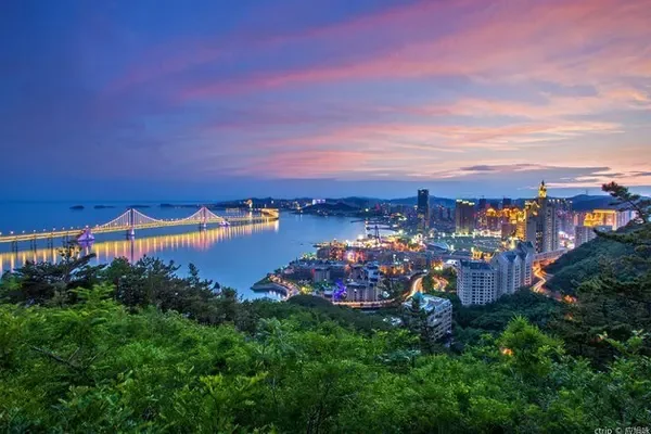
A group of beautiful mountains and rivers
Fall 2020